Documents in any scale with a geographical source, in which are represented geophysical, geological, demographic, economic, agricultural and other informations. They are used for studies, analysis and researches with spatial aspects.
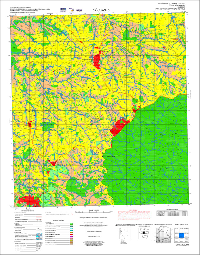 |


© 2017 Fototerra Aerial Survey LLC

